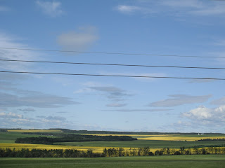
We left Dawson Creek about 10:30 deciding to have an easy driving day. The area surrounding Dawson Creek is largely filled with fields of Canola plants, tens of thousands of acres. Next time you crack open a bottle of Canola Oil think of this picture of the yellow Canola.
More broken promises from the Chamber of Commerce. We think they have more signs then actual wildlife. We did see one roadkill moose in the ditch. I think they can take down the sign now.
A roadside stop in Pink Mountain for lunch
After the Canola fields we began to see gas and oil sites out in the middle of nowhere. Ever wonder where the workers stay? At camps like these that are sprinkled along the road side every 50 miles or so.
We had decided to "Dry Camp" for the evening and found this abandoned / closed Wayside Provincial Park with no hook ups or facilities about 3pm. We call that roughing it. We were the only ones around, except this plane on this grass strip. Theories ranged from Meth lab to Oil Company plane.
We made ourselves at home, fired up our generators and microwaves. Ahh... yes roughing it,
"SMOOTHLY".
Certain that there were bears about Pam had her "Bear Spray"
Jerry cut wood for a fire.
Heidi stayed on alert watching for bears. Not having internet, TV or phone service is not always a bad thing. We enjoyed the fire and retelling old stories sprinkled with a few new ones.
No bears, no deer, no moose, no caribou, only mosquitos. I'm thinking of petitioning the Canadian government to replace the pictures of wildlife on their signs with depictions of vicious mosquitos.


